The Ling Canal lies in Xing’an County of the Guangxi Zhuang Autonomous Region.
After Qin Emperor Shihuang conquered the six states and united China, he ordered the construction of Ling Canal between 223BC and 214BC. At a length of 34 kilometers, the canal joins the Xiangjiang River and the Lijiang River, connecting the two water systems of the Yangtze River and the Pearl River. The whole canal system was finally completed, with numerous renovations during the Eastern Han (25-220) and Tang (618-907) Dynasties.
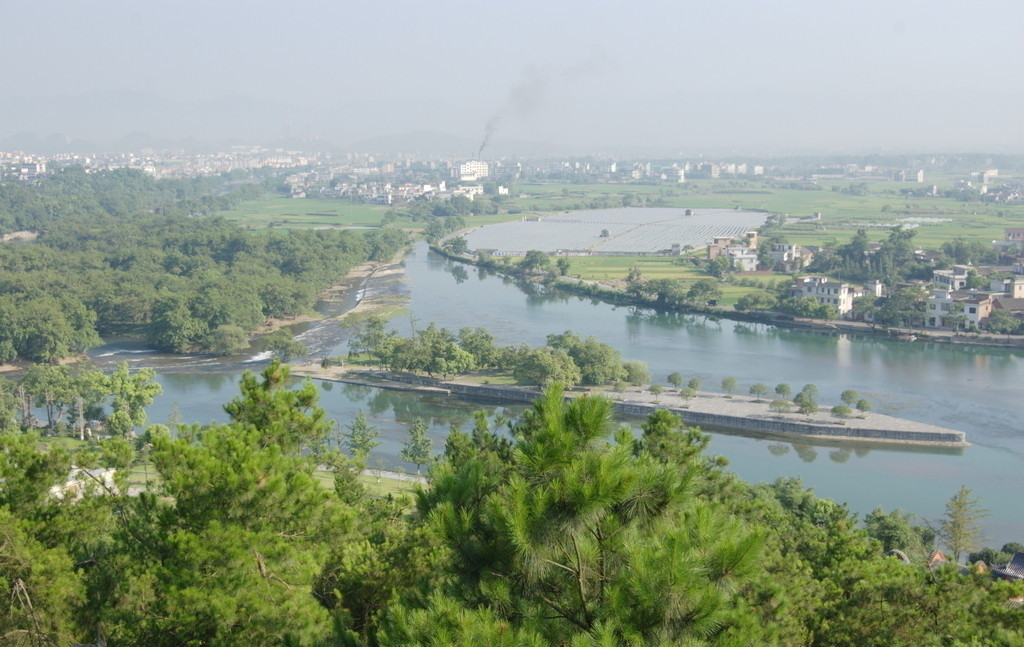
The Ling Canal is not only one of the most famous irrigation works in ancient China, but also a scenic spot with an enchanting landscape. The canal’s original name was Qinzao Canal, but it was renamed in the Tang Dynasty.
The watershed project of the Ling Canal is located in the reservoir, three kilometers east of Xing’an City. The project comprises a spade-shaped dam and two dykes. The dam is about six meters high, 74 meters long and 23.4 meters wide, cutting the Xiangjiang River into two streams. The two dykes, forming a ” Y” shape, further fortify the dam. The dykes are much shorter than both banks of the Xiangjiang River, allowing floodwater to pour down into its watercourse. In addition to blocking the river and channeling water into the canal, the watershed dam also automatically drains out excess water.
To solve problems of shallow, narrow, windings and rapid sections, dykes shaped like semi-circles are built where the water is shallow, rapidly raising the water level so boats can pass. Such dykes are the original form of water locks and the earliest control measure used in sea navigation in the world.
The Ling Canal connects the Pearl and Yangtze rivers, promoting economic and cultural exchanges between people of the Central Plain and the area south of the Five Ridges (Guangdong and Guangxi provinces). The canal has undergone many renovations since China’s liberation, and become an important irrigation canal in Xing’an.